 |
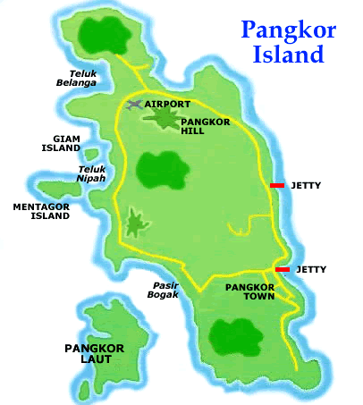
| Map of Pangkor Island |
 |
| Map of Lumut & Pangkor Island |
Pangkor Island (242km from Petaling Jaya; 23km from Sitiawan) - a popular island resort in Perak. Tourism & fishing are the major industries here.
In the 17th century, the Dutch built a fort in Pangkor island to defense their interests in this region.
The island is easily accessible by a regular ferry service from the Lumut port & jetty.
Pangkor Island Jetties - the 1st pier, Sungei Pinang Kechil (SPK) & the 2nd pier, Pangkor jetty in Pangkor town where tourists usually drop off
 |
| Sungei Pinang Kechil Jetty |
 |
| Pangkor Jetty |
 |
Arrival at the Pangkor Island Jetty - van hire with a driver for a 2 hour round the island visit to major touristy places - Rm70 (US$16.87)
Pangkor Island Town (next to Pier 2, Pangkor Jetty) - this is the main town where there are a number of souvenirs, dried seafood & coffee shops operate


Pekan Pulau Pangkor (Pangkor Island Village)


Masjid Teluk Raja Bayang ( Mosque)


Kota Belanda Dutch Fort - built in 1860 to defense the Dutch & locals against pirates attack. Located in Kampung Teluk Gedung


Foo Lin Kong Temple - a Taoist temple in Sungai Pinang Kechil Besar Village at the bottom of the Pangkor Hill
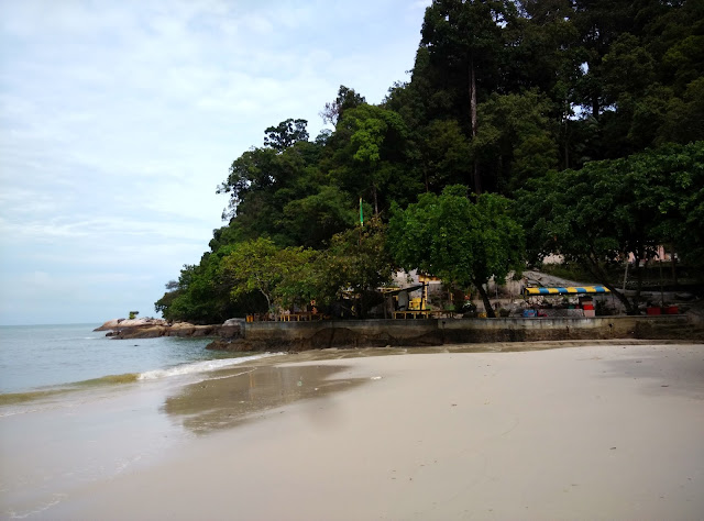
A beach near Lin Je Kong Temple
Galeri Pangkor
Pasir Bogak Beach - largest & most popular beach for tourists in Pangkor island
Pangkor Hill
Pangkor Island Airport - temporary ceased operation at the time of our visit except occasional chartered flights from Kuala Lumpur
Chinese Schools in Pangkor Island
Kilang Satay Eng Seng, Kampung Sungei Pinang Kechil - our van driver made a brief stopover for our group to buy some dried seafood catering mainly for the tourists


No comments:
Post a Comment